Flood Marks · Undated
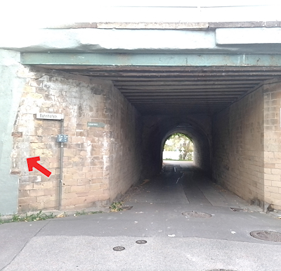
Hochwassermarken an Brücke Bahnhofstraße
Description
This description is only available in German.
Translate with Google opens this page in Google Translate (external service)
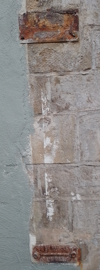
An der Brücke Moselstraße/Ecke Bahnhofstraße befinden sich am Torbogen zur Ortsseite hin zwei Hochwassermarken mit historischen Hochwasserereignissen.
Von oben nach unten:
Hochwassermarke 1 unleserlich
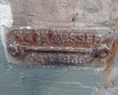
Hochwassermarke 2
HOCHWASSER
JANUAR 1955 [1]
Classification
- Subject area
- Architectural and Art Monuments
- Category
- Markers and Monuments
- Object type
- Flood Marks
- Date
- Undatiert
- Period
- Undated
Location
- District
- Trier-Saarburg
- Collective municipality
- Trier-Land
- Municipality
- Igel
- Street
- Bahnhofstraße
- Field name
- Aufm Weiher
- Coordinates
- WGS 84: 49.708125, 6.548297 (Position: exact) WGS 84: 49° 42′ 29.3″ N, 6° 32′ 53.9″ E UTM 32 (ETRS89): E 323241 · N 5509065
Sources
Data sources
- [1] Michael Grün, Trier, 2026.
On the internet
agulia.de/assets/files/sp_4-2023_web.pdf
Picture credits
Last edited: 15 Sep 2026 Object ID: 57735
https://kulturdb.de/en/objekt/57735-igel-hochwassermarken-an-bruecke-bahnhofstrasse
Nearby
The nearest objects
Farmhouses and Farm Buildings
Alter Pfarrhof
 30 m
Flood Marks
Hochwassermarken an Brücke Moselstraße
Washing Places
Ehemaliges Waschhaus
Fortresses and Bunkers
Westwall - Artillerie Beobachter-Stand
 90 m
Castles
Burghaus
 100 m
Market Towns
Marktort Igel
Fortresses and Bunkers
Westwall - Maschinengewehr-Schartenstand
 160 m
Wayside Shrines and Stations of the Cross