Flood Marks · Undated
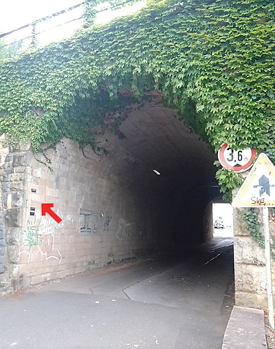
Hochwassermarken an Brücke Moselstraße
Description
This description is only available in German.
Translate with Google opens this page in Google Translate (external service)
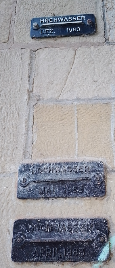
An der Brücke Moselstraße befinden sich am Torbogen zur Moselseite hin drei Hochwassermarken mit historischen Hochwasserereignissen.
Von oben nach unten:
HOCHWASSER
DEZ. 1993
HOCHWASSER
MAI 1983
HOCHWASSER
APRIL 1983 [1]
Classification
- Subject area
- Architectural and Art Monuments
- Category
- Markers and Monuments
- Object type
- Flood Marks
- Date
- Undatiert
- Period
- Undated
Location
- District
- Trier-Saarburg
- Collective municipality
- Trier-Land
- Municipality
- Igel
- Street
- Moselstraße
- Field name
- Aufm Weiher
- Coordinates
- WGS 84: 49.707890, 6.548134 (Position: exact) WGS 84: 49° 42′ 28.4″ N, 6° 32′ 53.3″ E UTM 32 (ETRS89): E 323228 · N 5509039
Sources
Data sources
- [1] Michael Grün, Trier, 2026.
On the internet
agulia.de/assets/files/sp_4-2023_web.pdf
Picture credits
Last edited: 15 Sep 2026 Object ID: 57734
https://kulturdb.de/en/objekt/57734-igel-hochwassermarken-an-bruecke-moselstrasse
Nearby
The nearest objects
Washing Places
Ehemaliges Waschhaus
 30 m
Flood Marks
Hochwassermarken an Brücke Bahnhofstraße
Farmhouses and Farm Buildings
Alter Pfarrhof
Fortresses and Bunkers
Westwall - Artillerie Beobachter-Stand
 110 m
Castles
Burghaus
 130 m
Market Towns
Marktort Igel
Fords
Ehemalige Moselfurt
Ferries