Wayside Shrines and Stations of the Cross · Undated
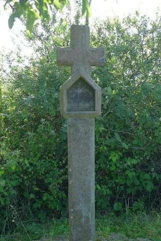
Holzkreuz am Marschbach

Description
This description is only available in German.
Translate with Google opens this page in Google Translate (external service)
Das Kreuz steht an der Brücke über den Marschbach und soll an den Brand des Dorfes 1848 erinnern.
Classification
- Subject area
- Architectural and Art Monuments
- Category
- Religious Buildings
- Object type
- Wayside Shrines and Stations of the Cross
- Date
- Undatiert
- Period
- Undated
Location
- District
- Vulkaneifel
- Collective municipality
- Daun
- Municipality
- Wallenborn
- Field name
- Am Niederstadtfelder Pfad
- Coordinates
- WGS 84: 50.155339, 6.737462 (Position: exact) WGS 84: 50° 09′ 19.2″ N, 6° 44′ 14.9″ E UTM 32 (ETRS89): E 338381 · N 5558353
Sources
Data sources
- Georg Jakob Meyer: Wegekreuze im Trierer Land; 1955 und Uwe Widera, 54550 Daun, 2009.
On the internet
Picture credits
- Picture 1: Chronik der Gemeinde Wallenborn
Last edited: 20 Sep 2009 Object ID: 17519
https://kulturdb.de/en/objekt/17519-wallenborn-holzkreuz-am-marschbach
Nearby
The nearest objects
 560 m
Wayside Shrines and Stations of the Cross
Wegekreuz östlich der Ortslage
 590 m
Viewpoints
Aussichtspunkt östlich der Ortslage
No picture
600 m
Field Names
Auf dem Hundshüwel
No picture
620 m
Field Names
Im Klopp
No picture
650 m
Field Names
Auf dem Runnenkolwerrech
 690 m
Beeches
Rotbuche
No picture
720 m
Field Names
Hemmerather Gewann
No picture
810 m
Field Names