Surveying · Historicism / Art Nouveau
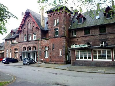
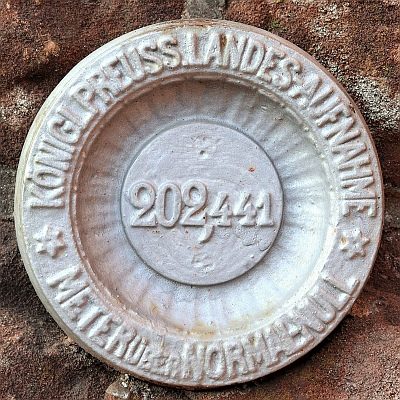
Bahnhof Ehrang - Höhenpunkt
- Listed monument


Description
This description is only available in German.
Translate with Google opens this page in Google Translate (external service)
Höhenpunkt mit Höhenangabe: 130 Meter über NHN.
Bundesbahn-Haltepunkt, ehemaliger Bahnhof der Eifelbahn; wohl nach 1881 begonnen; Ensemble aus Empfangsgebäude, Schuppen und Bedienstetenwohnhaus, das Empfangsgebäude ein malerischer Gruppenbau mit Rotsandsteinfassaden. [1]
Classification
- Subject area
- Architectural and Art Monuments
- Category
- Markers and Monuments
- Object type
- Surveying
- Date
- Nach 1881
- Creator, builder, architect, artist
- Raschdorff, Julius Carl (Architekt), Berlin [1823-1914]
Location
- District
- City of Trier
- Collective municipality
- Verbandsfreie Gemeinde Trier
- Town
- Trier
- Locality / location
- Ehrang-Quint
- Street
- Ehranger Straße 2, 3, 4, 5, 7 und 8
- Field name
- Ortslage
- Coordinates
- WGS 84: 49.801986, 6.685540 (Position: exact) WGS 84: 49° 48′ 07.1″ N, 6° 41′ 07.9″ E UTM 32 (ETRS89): E 333457 · N 5519185
Sources
Data sources
- [1] Denkmalliste der Generaldirektion Kulturelles Erbe, Rheinland-Pfalz; 2010.
On the internet
Picture credits
Last edited: 21 Jun 2018 Object ID: 47825
https://kulturdb.de/en/objekt/47825-trier-bahnhof-ehrang-hoehenpunkt
Nearby
The nearest objects
 less than 10 m
Railways
Bahnhof Ehrang
 30 m
Plane Trees
Platane am Bahnhof Ehrang
Fortresses and Bunkers
Ehemaliger Reichsbahnbunker
Field Names
Unter dem Maarhübel durch den Pfalzerweg
Field Names
Oben bei der Maarwies
Field Names
Im Maarhübel
 120 m
Surveying
Nivellements-Nummernbolzen
Field Names