Viewpoints · Undated
Aussichtspunkt Braunes

Description
This description is only available in German.
Translate with Google opens this page in Google Translate (external service)
Auf Höhenpunkt 265,0 Meter über NHN. [1]
Classification
- Subject area
- Natural Features
- Category
- Viewpoints
- Date
- Undatiert
- Period
- Undated
Location
- District
- Bernkastel-Wittlich
- Town
- Bernkastel-Kues
- Locality / location
- Bernkastel
- Field name
- Unter Tanisch
- Coordinates
- WGS 84: 49.927567, 7.077061 (Position: exact) WGS 84: 49° 55′ 39.2″ N, 7° 04′ 37.4″ E UTM 32 (ETRS89): E 361986 · N 5532350
Sources
Data sources
- [1] Wanderkarten im Maßstab 1:50.000 und 1:25.000
On the internet
de.wikipedia.org/wiki/Bernkastel-Kues
Picture credits
- Picture 1: © Michael Grün, Trier, 2019.
Last edited: 8 Oct 2019 Object ID: 48509
https://kulturdb.de/en/objekt/48509-bernkastel-kues-aussichtspunkt-braunes
Nearby
The nearest objects
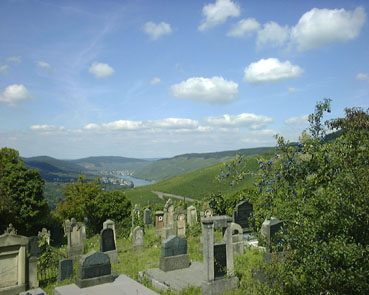 30 m
Jewish Cemeteries
Neuer jüdischer Friedhof
No picture
180 m
Vineyard Sites
Held
No picture
180 m
Vineyard Sites
Schwanen
No picture
200 m
Jewish Cemeteries
Ehemaliger Begräbnisplatz der Juden
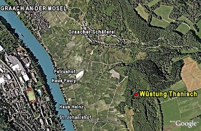 210 m
Deserted Settlements
Wüstung Thanisch
No picture
270 m
Vineyard Sites
Mönch
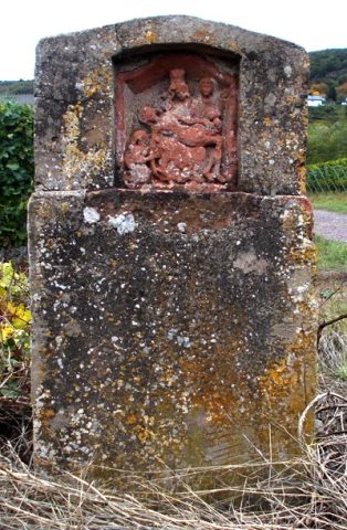 320 m
Wayside Shrines and Stations of the Cross
Heiligenhäuschen
No picture
500 m
Vineyard Sites