Dry Maars · Undated
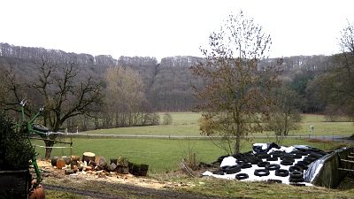
Sprinker Maar


Classification
- Subject area
- Natural Features
- Category
- Maars
- Object type
- Dry Maars
- Date
- Undatiert
- Period
- Undated
Location
- District
- Vulkaneifel
- Collective municipality
- Daun
- Municipality
- Strohn
- Locality / location
- Sprink
- Field name
- Im Ring
- Coordinates
- WGS 84: 50.101308, 6.938858 (Position: exact) WGS 84: 50° 06′ 04.7″ N, 6° 56′ 19.9″ E UTM 32 (ETRS89): E 352600 · N 5551929
Sources
Data sources
- Zeichnung 1:100.000 von Ing. Bernard Jakobs, Trier. Mürmes - Ein Moor in der Vulkaneifel und seine Vogelwelt, in: Landskundliche Vierteljahresblätter 1961, Heft 2.
On the internet
Picture credits
Last edited: 20 Feb 2011 Object ID: 6707
https://kulturdb.de/en/objekt/6707-strohn-sprinker-maar
Nearby
The nearest objects
 50 m
Volcanoes
Vulkan Sprinker Maar
No picture
240 m
Field Names
Breitwies
No picture
320 m
Extraction and Processing of Raw Materials
Mühlsteinbruch im Alftal bei Sprink
No picture
390 m
Wayside Shrines and Stations of the Cross
Wegekreuz
No picture
400 m
Field Names
Ober der Breitwies
 410 m
Farmhouses and Farm Buildings
Bockfachwerkhaus
No picture
530 m
Field Names
Auf der Breitwies
No picture
590 m
Field Names