Deserted Settlements · Neoclassicism
Wüstung Herschelt


© GeoBasis-DE / LVermGeoRP, dl-de/by-2-0
There is no picture of this object yet. Do you have a photo that you would like to make available to the Kulturdatenbank? Submit a picture
Description
This description is only available in German.
Translate with Google opens this page in Google Translate (external service)
Vermutete Wüstung. [1]
Classification
- Subject area
- Archaeological Monuments
- Category
- Settlements
- Object type
- Deserted Settlements
- Date
- Circa 1750 bis 1850
- Period
- Neoclassicism
Location
- District
- Vulkaneifel
- Collective municipality
- Gerolstein
- Municipality
- Kalenborn-Scheuern
- Locality / location
- Kalenborn
- Field name
- In Herschelt
- Coordinates
- WGS 84: 50.265280, 6.620716 (Position: presumed) WGS 84: 50° 15′ 55.0″ N, 6° 37′ 14.6″ E UTM 32 (ETRS89): E 330433 · N 5570835
Sources
Data sources
- [1] Janssen, W.: Studien zur Wüstungsfrage im fränkischen Altsiedelland zwischen Rhein, Mosel und Eifelnordrand. 2 Bände. Text u. Katalog, 1975.
On the internet
Last edited: 7 Oct 2003 Object ID: 902
https://kulturdb.de/en/objekt/902-kalenborn-scheuern-wuestung-herschelt
Nearby
The nearest objects
Field Names
In der Nachtsweide
Field Names
Bei Jakobsloch
Field Names
In der Hasengich
 520 m
Rocks
Basaltköpfchen im Roßbüsch
 570 m
Volcanoes
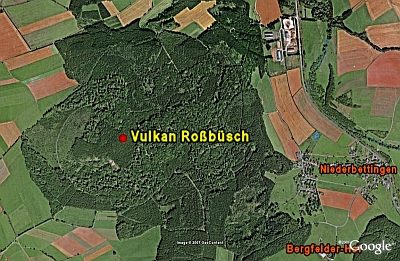
Vulkan Roßbüsch
Extraction and Processing of Raw Materials
Mühlsteinbruch am Roßbüsch
Dry Maars
Rother Maar
750 m
Rocks