Road Transport · Celtic / Roman Period
Steinerne Brückenreste


© GeoBasis-DE / LVermGeoRP, dl-de/by-2-0
There is no picture of this object yet. Do you have a photo that you would like to make available to the Kulturdatenbank? Submit a picture
Description
This description is only available in German.
Translate with Google opens this page in Google Translate (external service)
Fundstelle 938
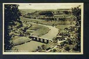
Noch im 19. Jahrhundert waren im Ortsbereich von Wallendorf steinerne Brückenreste unterhalb der 1875 erbauten Brücke zu erkennen. Ihre Datierung ist unsicher, Steinhausen vermutete römische Zeitstellung.
Schneider 1843, 34; Steinhausen 1932, 363; Bonner Jahrb. 7, 1845, 127
in: Römisch-Germanische Forschungen, Bd. 63. Eisenzeitlicher Kulturwandel und Romanisierung im Mosel-Eifel-Raum. Die keltisch-römische Siedlung von Wallendorf und ihr archäologisches Umfeld. Römisch-Germanische Kommission des Deutschen Archäologischen Instituts Frankfurt a. M. Fundstellenkatalog von: Dirk L. Krausse unter Mitarbeit von Antje Fischbock. 2006
Classification
- Subject area
- Archaeological Monuments
- Category
- Economy, Trade and Transport
- Object type
- Road Transport
- Date
- Circa 500 vor Chr. bis circa 500 nach Chr.
- Period
- Celtic / Roman Period
Location
- District
- Eifelkreis Bitburg-Prüm
- Collective municipality
- Südeifel
- Municipality
- Wallendorf
- Field name
- [Sauer]
- Coordinates
- WGS 84: 49.875011, 6.290784 (Position: exact) WGS 84: 49° 52′ 30.0″ N, 6° 17′ 26.8″ E UTM 32 (ETRS89): E 305348 · N 5528254
Sources
Data sources
- Fundstellenkatalog: Die keltisch-römische Siedlung von Wallendorf und ihr archäologisches Umfeld. Dirk L. Krausse unter Mitarbeit von Antje Fischbock. 2006
On the internet
Last edited: 13 Aug 2007 Object ID: 13083
https://kulturdb.de/en/objekt/13083-wallendorf-steinerne-brueckenreste
Nearby
The nearest objects
 50 m
Road Transport
Brücke über die Sauer
Wayside Shrines and Stations of the Cross
Schaftkreuz von 1607
 140 m
Wayside Shrines and Stations of the Cross
Wegekreuz
Cremation Graves
Römische Gräber
Burial Mounds
Fränkische Gräber
Farmhouses and Farm Buildings
Wohnhaus
 250 m
Wayside Shrines and Stations of the Cross
Kreuzweg - 6. Station
260 m
Wayside Shrines and Stations of the Cross