Settlements · Celtic / Roman Period
Römische Baureste


© GeoBasis-DE / LVermGeoRP, dl-de/by-2-0
There is no picture of this object yet. Do you have a photo that you would like to make available to the Kulturdatenbank? Submit a picture
Classification
- Subject area
- Archaeological Monuments
- Category
- Settlements
- Object type
- Settlements
- Date
- Circa 500 vor Chr. bis circa 500 nach Chr.
- Period
- Celtic / Roman Period
Location
- District
- Trier-Saarburg
- Collective municipality
- Saarburg-Kell
- Municipality
- Schoden
- Field name
- Feils
- Coordinates
- WGS 84: 49.641911, 6.580851 (Position: exact) WGS 84: 49° 38′ 30.9″ N, 6° 34′ 51.1″ E UTM 32 (ETRS89): E 325351 · N 5501628
Sources
Data sources
- [1] Grebe, Heinrich, 1877: "Geologische Spezialkarte von Preussen und den Thüringischen Staaten" und Nachfolgewerke; [Neue Nr.6305]; Saarburg; Gradabteilung 80, Blatt 20. Kraatz, Berlin, DOI 10.23689/fidgeo-3844.
- CC Public Domain Mark 1.0 https://e-docs.geo-leo.de/handle/11858/8174#
On the internet
Last edited: 19 May 2021 Object ID: 50517
https://kulturdb.de/en/objekt/50517-schoden-roemische-baureste
Nearby
The nearest objects
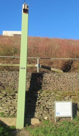 120 m
Flood Marks
Hochwassermarke am Saaruferweg
No picture
150 m
Field Names
Im Feils Hostert
No picture
190 m
Field Names
Ober Feils Hostert
 200 m
Field Names
Im Hanfgarten
No picture
200 m
Fortresses and Bunkers
Westwall - Maschinengewehr-Schartenstand
No picture
220 m
Field Names
Murtengarten
No picture
260 m
Settlements
Römische Baureste
No picture
290 m
Field Names