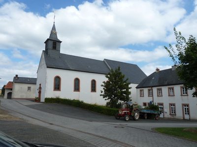
Bitburger Land
3,990 heritage sites in the collective municipality of Bitburger Land in the Kulturdatenbank Region Trier.
The map shows all 3,990 results.
-
Brandgrab
Burials Cremation Graves ID 12525
-
Denkmalzone in der Hauptstraße
Historic Townscapes ID 10698
-
Die Wolfskaul
Field Names ID 36856
-
Ehemalige Burg auf dem Goldberg
Fortifications and Military Sites Castles ID 53024
-
Ehemalige Schule
Educational Institutions Schools ID 10700
-
Ehemaliger Kalkofen
Economy, Trade and Transport Lime Kilns ID 19409
-
Ehemaliger Kalkofen
Economy, Trade and Transport Lime Kilns ID 19410
-
Ehemaliger Pfarrhof von 1792
Residential and Farm Buildings Farmhouses and Farm Buildings ID 10696
-
Ehemaliges Wohnhaus von 1794
Residential and Farm Buildings Farmhouses and Farm Buildings ID 10694
-
Eisenerzabbau am Eisenkopf
Economy, Trade and Transport Extraction and Processing of Raw Materials ID 13434
-
Eisenkopf
Field Names ID 36532
-
Flurküchenhaus
Residential and Farm Buildings Farmhouses and Farm Buildings ID 10695
-
Friedhofskreuz
Markers and Monuments War Memorials ID 10697
-
Fundstellen tierischer Versteinerungen
Geological Features Fossils ID 51015
-
Fundstellen tierischer Versteinerungen
Geological Features Fossils ID 51021
-
Giemes
Field Names ID 25597
-
Grabhügelgruppe
Burials Burial Mounds ID 12526
-
Hasselt
Field Names ID 25606
-
Heiligenhäuschen
Religious Buildings Wayside Shrine Houses ID 10699
-
Hinter dem Goldberg
Field Names ID 36460
-
Im Bungert
Field Names ID 28301
-
In Griewenpesch
Field Names ID 27150
-
In Göhl
Field Names ID 25607
-
In den Strechen
Field Names ID 29817
-
In den nassen Feldern
Field Names ID 36051
-
Jüdische Kultur
Religious Buildings Synagogues ID 2912
-
Kreuz mit Altartisch
Religious Buildings Altars ID 10689
-
Oben auf der Kuhkehr
Field Names ID 38090
-
Oberm Rinderweg
Field Names ID 55160
-
Ortsbild
Historic Townscapes ID 3757
-
Ortsname / Ortsgeschichte
Place Names / Local History ID 3758
-
Pfarrgeschichte
Place Names / Local History ID 9116
-
Quereinhaus
Residential and Farm Buildings Farmhouses and Farm Buildings ID 35093
-
Römische Siedlungsstelle
Settlements Settlements ID 12524
-
Schaftkreuz an der Straße nach Orsfeld
Religious Buildings Wayside Shrines and Stations of the Cross ID 10691
-
Schaftkreuz beim Friedhof
Religious Buildings Wayside Shrines and Stations of the Cross ID 10690
-
Unter Kuhkehr
Field Names ID 38089
-
Unter dem Fußfall
Field Names ID 25602
-
Unter dem Rinderweg
Field Names ID 55161
-
Vor dem Sarg
Field Names ID 51284
-
Vor der Höhe
Field Names ID 25599
-
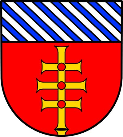
Wappen der Gemeinde Gindorf
Coats of Arms ID 5427
-
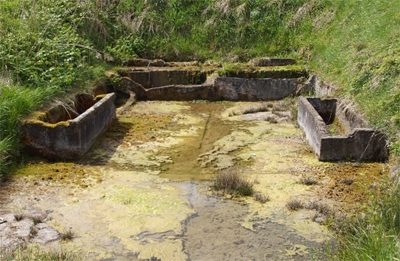
Waschhaus im Weilbachtal
Historic Townscapes Washing Places ID 3756
-
Wegekreuz
Religious Buildings Wayside Shrines and Stations of the Cross ID 28550
-
Wegekreuz
Religious Buildings Wayside Shrines and Stations of the Cross ID 28551
-
Weilbach
Field Names ID 25604
-
Winkelhof
Residential and Farm Buildings Farmhouses and Farm Buildings ID 35094