Trier-Land
3,433 heritage sites in the collective municipality of Trier-Land in the Kulturdatenbank Region Trier.
The map shows all 3,433 results.
-
Beim Heppelborn
Field Names ID 31123
-
Bornwerth
Field Names ID 31068
-
Bornwerth
Field Names ID 31076
-
Ehemalige Fähre durch die Sauer
Economy, Trade and Transport Ferries ID 49562
-
Ehemalige Mühle
Engineering Structures and Industrial Sites Mills ID 37998
-
Ehemaliger Steinbruch
Economy, Trade and Transport Extraction and Processing of Raw Materials ID 34725
-
Ehemaliger Steinbruch
Economy, Trade and Transport Extraction and Processing of Raw Materials ID 34726
-
Ehemaliger Steinbruch
Economy, Trade and Transport Extraction and Processing of Raw Materials ID 34727
-
Ehemaliges Bahnhofsgebäude Wintersdorf
Engineering Structures and Industrial Sites Railways ID 2974
-
Felsinschrift
Markers and Monuments Inscriptions ID 49557
-
Fränkische Hofgruppe
Settlements Settlements ID 11150
-
Fränkischer Friedhof
Burials Burial Mounds ID 11147
-
Furt durch den Zinziger Bach
Economy, Trade and Transport Fords ID 49556
-
Grabhügelgruppe
Burials Burial Mounds ID 12625
-
Grabmonument
Burials Roman Tombs ID 24063
-
Im Hofwingert
Vineyard Sites ID 39233
-
Im Katzenberg
Field Names ID 38331
-
Im Rödchen
Field Names ID 43917
-
Im Röderfeld
Field Names ID 42059
-
Im Wingert
Vineyard Sites ID 39232
-
Im vordersten Wingert
Vineyard Sites ID 39234
-
In den nassen Morgen
Field Names ID 29280
-
In der Bornwies
Field Names ID 31119
-
In der Langfuhr
Field Names ID 34329
-
In der Wingertsheck
Vineyard Sites ID 39230
-
Lesefund von tupfenverzierter Keramik
Settlements Find Sites ID 12728
-
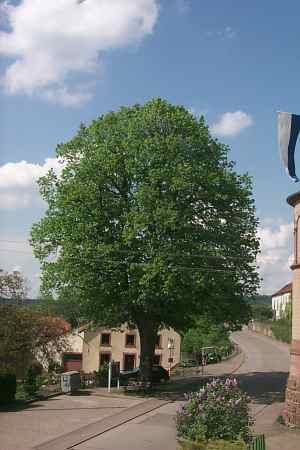
Linde an der Kirche
Trees Lime Trees ID 2825
-
Lindengruppe am ehemaligen Bahnhofsgebäude
Trees Lime Trees ID 2975
-
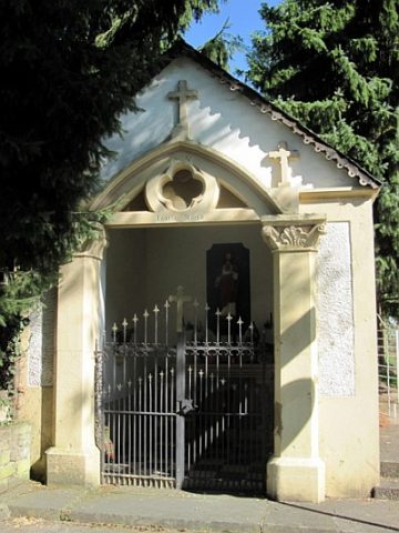
Marienkapelle am Sauerufer
Religious Buildings Chapels ID 19289
-
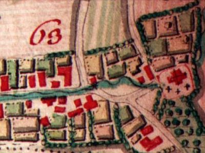
Ortsgeschichte Wintersdorf
Place Names / Local History ID 2450
-
Roederwald
Field Names Forest Names ID 49572
-
Röderbusch
Field Names ID 42031
-
Römisch-fränkischer Friedhof
Burials Roman Tombs ID 11148
-
Römische Brückenkonstruktion
Economy, Trade and Transport Road Transport ID 12746
-
Römische Trümmerstätte
Settlements Settlements ID 12984
-
Siedlungsstelle Assem
Settlements Settlements ID 12745
-
Säulenkreuz
Südlich der Ortslage nahe der Kreisstraße 7
Religious Buildings Wayside Shrines and Stations of the Cross ID 9157
-
Säulenschaftkreuz auf der Ernst
Religious Buildings Wayside Shrines and Stations of the Cross ID 49569
-
Trigonometrisches Signal Auf der Ehrens
Markers and Monuments Surveying ID 45889
-
Unter den Röder
Field Names ID 42055
-
Walnussbäume
Trees Walnut Trees ID 2976
-
Wegekreuz
Religious Buildings Wayside Shrines and Stations of the Cross ID 32527
-
Wegekreuz
Religious Buildings Wayside Shrines and Stations of the Cross ID 32528
-
Westwall - Bunker
Baustärke B1 oder stärker
Fortifications and Military Sites Fortresses and Bunkers ID 21626
-
Westwall - Bunkertyp nicht eindeutig erkennbar
Fortifications and Military Sites Fortresses and Bunkers ID 21953