Vulkaneifel
7,758 heritage sites in Vulkaneifel in the Kulturdatenbank Region Trier.
The map shows all 7,758 results.
-
Im Tönnespesch
Field Names ID 27192
-
Koellersborn unterster Büsch
Field Names ID 32147
-
Messenpfad
Field Names ID 38395
-
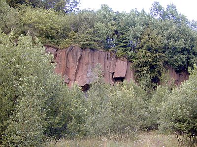
Mühlsteinbruch am Ernstberg
Naturdenkmal
Economy, Trade and Transport Extraction and Processing of Raw Materials ID 5152
-
Mühlsteinbruch am Ernstberg
Economy, Trade and Transport Extraction and Processing of Raw Materials ID 24179
-
Mühlsteinbruch am Hangelberg
Economy, Trade and Transport Extraction and Processing of Raw Materials ID 24129
-
Ober dem Messenpfad
Field Names ID 38392
-
Ober dem Messenpfad
Field Names ID 38394
-
Ober der Kuhtrift
Field Names ID 28370
-
Römische Grabhügel
Burials Burial Mounds ID 12212
-
Römische Siedlungsstelle
Settlements Settlements ID 12211
-
Römisches Heiligtum
Religious Buildings Temples, Sanctuaries ID 12964
-
Steinkaul
Field Names ID 27732
-
Streckhof
Residential and Farm Buildings Town Houses and Commercial Buildings ID 34164
-
Traufständiger Streckhof
Field Names ID 35200
-
Trigonometrisches Signal
Markers and Monuments Surveying ID 49608
-
Unten in der Bornwies
Field Names ID 32193
-
Unter Erzenrech
Field Names ID 36162
-
Unter Erzenrech
Field Names ID 36163
-
Unter Winkel auf den Sühren
Field Names ID 39915
-
Unter dem Ahnborn
Field Names ID 32194
-
Unter dem Messenpfad
Field Names ID 38393
-
Unter dem Mühlenrech
Field Names ID 29945
-
Unter dem Tönnespesch
Field Names ID 27193
-
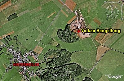
Vulkan Hangelberg
Geological Features Volcanoes ID 6634
-
Wegekreuz
Religious Buildings Wayside Shrines and Stations of the Cross ID 26342
-
Wegekreuz
Religious Buildings Wayside Shrines and Stations of the Cross ID 26343
-
Wegekreuz
Religious Buildings Wayside Shrines and Stations of the Cross ID 26344
-
Wegekreuz
Religious Buildings Wayside Shrines and Stations of the Cross ID 26345
-
Wegekreuz
Religious Buildings Wayside Shrines and Stations of the Cross ID 33607
-
Wüstung Oberweiler
Settlements Deserted Settlements ID 785
-
An Güssenrech
Field Names ID 29970
-
Auf Güssenrech
Field Names ID 29966
-
Auf der Sauerwies
Field Names ID 34478
-
Auf der krummen Heck
Field Names ID 42369
-
Auf der rothen Heck
Field Names ID 43321
-
Basaltbruch Mühlenberg
Economy, Trade and Transport Extraction and Processing of Raw Materials ID 42729
-
Ehemaliger Torfstich
Bogs and Mires Peat Cuttings ID 42267
-
Ehemaliger Torfstich
Bogs and Mires Peat Cuttings ID 42268
-
Essinger Maar
Maars ID 30185
-
Felsenzüge im Gyppenberg
Rocks ID 16630
-
Führungsbunker
Luftverteidigungszone (LVZ) West
Fortifications and Military Sites Fortresses and Bunkers ID 50225
-
Geschützstellung
Luftverteidigungszone (LVZ) West
Fortifications and Military Sites Fortresses and Bunkers ID 50222
-
Im Haringsrech
Field Names ID 29962
-
Im Scheid
Field Names ID 28668